GSI Engineering, LLC is pleased to introduce its new drone (unmanned aerial vehicle) capabilities. Rick Bean, Director of Environmental Operations, believes that offering drone capability to clients provides a new tool that could revolutionize how environmental assessments and monitoring are conducted. Environmental uses are a big part of the potential future role of drones, ranging from pipeline monitoring, transmission line inspections, environmental assessments and conservation applications. GSI has two licensed remote pilots who have already flown several projects.
Travis Wiley, an Environmental Scientist and licensed remote pilot with GSI, provides his personal perspective on GSI’s first flights
I enjoy looking at a problem from different angles. Taking a step back and looking at something from a different location or perspective can sometimes make the difference in determining a solution to a problem. When I first flew an Unmanned Aerial Vehicle (UAV) it was exhilarating and fascinating. My first flight was in the mountains in an area that I enjoyed hiking in. Seeing this area from the viewpoint of the UAV seemed to open up an entirely new world of opportunity. I was hooked.
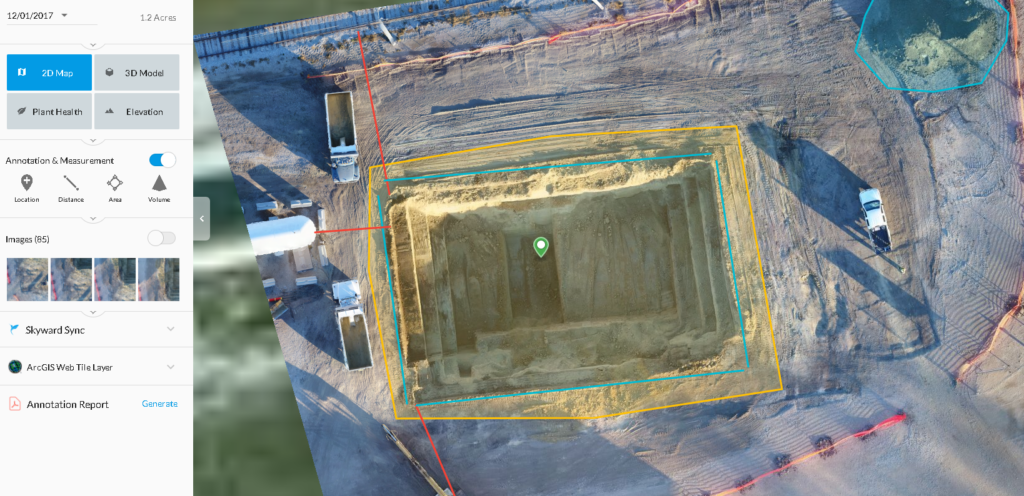
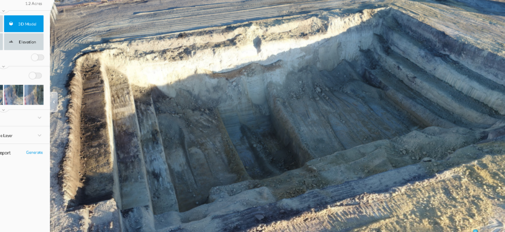
With GSI, I have had opportunities to learn and experience many new things over the past year. When I was given an assignment as Site Supervisor to oversee a large excavation of contaminated soil, my first thought was how I could use the UAV to assist me in monitoring the project. Using Drone Deploy, I created a flight plan over the excavation. Part of my job was calculating contaminated soil removed based on loads excavated. The dump trucks did not carry the same volume of soil each time, so I wanted to be able to have an accurate volume of soil to report to my management and the client. Using the UAV I found that I could create maps that would calculate the volumes, both of soil removed and soil located in piles. I could also calculate distances between objects. The best thing was that it did not take long to accomplish these calculations. With nine minutes of flight time and a couple hours of processing I could create a very accurate and useful map.


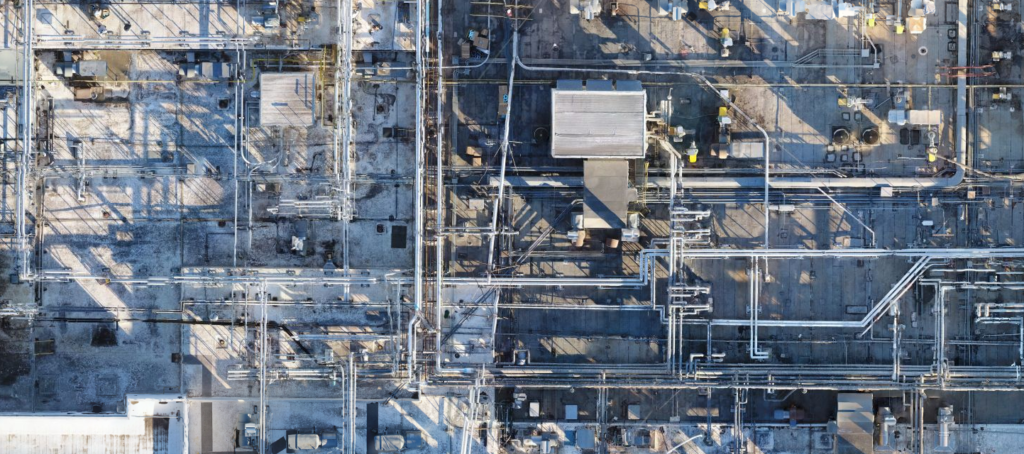
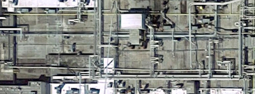
Excavation is only one use of the unique view the drone can provide. Being able to fly above and look down at a building can provide additional information, especially if there is a lot of structures on the roof.


For example, the above two photos clearly show the detail that a UAV can provide between aerial imagery from the drone and from Google Satellite imagery.
This new perspective offers solutions to problems and provides Clients and managers a visual view of the project even though they are not onsite. It also provides useable documentation of the progress of a project. There are so many other applications that I look forward to working on for Clients. I have enjoyed working on these projects and look forward to finding new problems to solve.